| ?देहरादून Dehradun Uttarakhand• India | |
|
| |
| Coordinates: | |
| Time Zone | IST(UTC+5:30) |
| Elevation | • 635 m (2,083 ft) |
| District | Dehradun |
| Population | 447,808 (2001) |
| Codes • Telephone |
• +91-135 |
Coordinates: Dehradun (Hindi: देहरादून) pronunciation, also sometimes spelled Dehra Doon, is the capital city of the Uttrakhand state (earlier called Uttaranchal) of India.
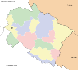
It is located in the Doon valley, 230 kilometers north of India's capital New Delhi and the Delhi metropolitan area. The district is surrounded by the Himalyas(Shivalik Hills), the river Ganga in the east, and the river Yamuna in the west.
Before the creation of Uttrakhand on November 9 2000, Dehradun was a part of Uttar Pradesh. Neighbouring cities and towns include Haridwar, Rishikesh, Roorkee, Mussoorie & Saharanpur.
A product that has made Dehradun known within India is "Dehradooni basmati rice" and Lychee, besides it has always been known as the home of institutions like, Survey of India, Forest Research Institute(FRI), and educational institutions like, Rashtriya Indian Military College(RIMC), Indian Military Academy(IMA) and The Doon School.
History:
Dera (or Dehra) is a camp, while Dun or Doon is a reference to a local term used for a river valley between a smaller range (Shivaliks) and the main Himalayas, and the present town of Dehradun was founded in the early eighteenth century by 'Guru Ram Rai', the elder son of seventh Sikh Guru, Guru Har Raj, and the founder of the Udasi sect of Ascetics, who came here in 1675, and first settled in village Dhamawala which even today hosts the annual 'Jhanda Fair' on the fifth day after Holi in his memory. Thus the name refers to his Dera or settlement in the valley, and marking this settlement is a Gurudwara called 'Guru Ram Rai Darbar', built in 1699, and modelled on the tomb of Mughal Emperor Jehangir.

According to a legend, Lord Ram and Lakshman did penance here for killing Ravana, & it is believed that Lord Lakshman earned his powers (siddhis) in the jungles here. There is a temle known as Lakshman-Siddh on the Dehradun-Haridwar Higway.In Skanda Purana, Dun is mentioned as a part of the region called 'Kedar Khand', the abode of Shiva. Another belief states that Drona, the great teacher of Kauravas and Pandavas lived here, for a brief period hence the name, "Drona-nagri"
Geography and Climate: Dehradun has a sub-tropical climate with cool winters, warm and crisp springs, hot summers and a strong monsoon. The mountains around Dehradun receive sustained snowfall in winter, but the temperature in the city hardly ever drops below freezing
| Dehradun | |||||||||||
|---|---|---|---|---|---|---|---|---|---|---|---|
| J | F | M | A | M | J | J | A | S | O | N | D |
|
47
19
3 |
55
22
5 |
52
26
9 |
21
32
13 |
54
35
17 |
230
34
20 |
631
30
22 |
627
30
22 |
261
30
20 |
32
28
13 |
11
24
7 |
3
21
4 |
|
temperatures in °C • precipitation totals in mm | |||||||||||
You can have an idea about the climate of Dehradun by the given Climate Chart of Dehradun.
Culture: The posh city of Dehradun is bustling. It is the state capital and is also the home of many government institutions. The center of city's activities is the popular landmark known as the Clock-Tower (Ghanta-ghar), which is a tall structures with 5 functioning clocks; . The numerous high schools of the city attract students from all over the country. During the day it is common to see students (dressed in various high-school uniforms) to be moving around the city. Even though city transportation is now taken care of by blue striped city buses crisscrossing the city, another popular site are the omnipresent blue three wheel vehicles (known as "Vikrams"). These vehicles provide the most common and cheapest form of public transport, however, these vehicles have also been cited as the chief cause of increased levels of noise and air pollution in the city.
 The clock tower of Dehradun
Economy: The city has witnessed tremendous growth in the last 20 years. Because of its educational background and high international remittances, Dehradun enjoys a high per capita income, which in dollar terms hovers close to $1800 (national average $800). The city's transition into a large urban cetre has been nothing less than phenomenal. Dehradun is in a middle of a commercial boom, which is amplified by the establishment of various SEZ (special economic zones)through out the city. Right from IT parks to specifically built industrial belts have proved to be a haven for industrialists of national and international repute. Combined with excise benefits companies are finding prospective establishment in the city (like other parts of Uttranchal) very attractive. With the construction of Delhi-Dehradun four lane highway now on full swing, the primary bottle neck endangering the city's growth (the Delhi-Dehradun two lane highway) has been solved. More economic development is expected at a much wider scale.
Tourism:

 Dehradun, India |
 Dehradun Night View from Midway Mussorie. |
 |